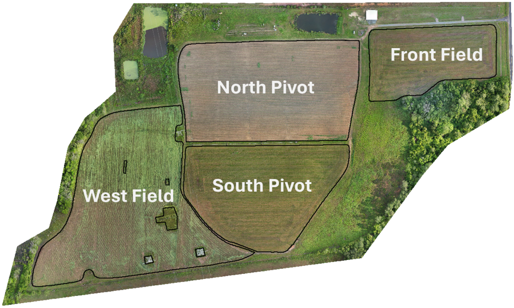
West Field – Cover: Cereal Rye, 43 DAP; 2024 Crop: Dryland Peanuts
Recent Activities
This week at the DATA Farm was chilly; Wednesday morning hit a low of 20°F. Fortunately, the weather front Tuesday brought only brief misting rain. This allowed the Front and South Pivot Fields to dry out enough to apply fertilizer. On Thursday, Omega Farm Supply applied 50 lbs. N per acre using their spreader. We opted to use their spreader because their wider tires provide extra flotation. Thisminimized damage to the ryegrass and only created ruts in one soft spot of the Front field.
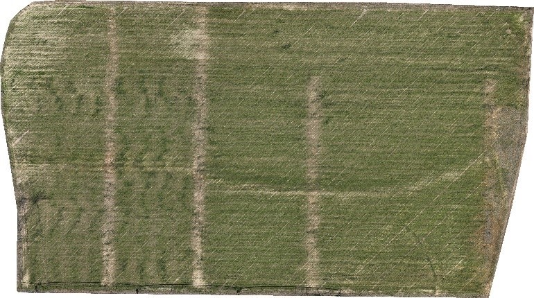
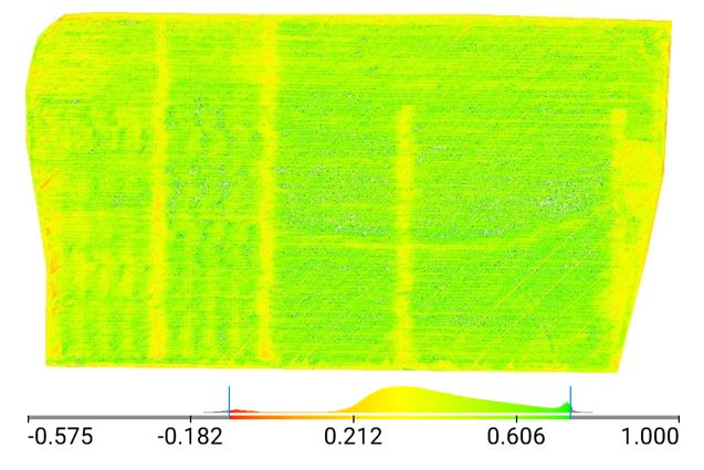
The ABAC team received a DJI Mavic 3M drone. This drone has RTK GPS and multispectral sensors. This will improve the clarity and consistency of our normal aerial maps, plus multispectral will provide analysis of crop health. The first flight on Wednesday produced the following aerial images; if you would like a full-resolution copy,contact Nick Gladden.
In addition to the drone purchase, the quotes for adding variable rate irrigation to the Valley pivot and adding a weather station to the RealmFive sensor network came in. These are currently working their way through the ABAC purchasing system.
On Tuesday, Nick Gladden gave a presentation on how the Veris is used to gatherelectrical conductivity (EC) data to Dr. Taylor Hendricks’ Soil Management class of 22 students. He also explained the process Dr. Wes Porter used to determine soil sensor location by overlaying ECand elevation data collected on the DATA Farm on an aerial image of the farm to show pivot sections.
Upcoming Week
Operations: Monitor ryegrass response to nitrogen application
Water needs: None
Sensors: New RealmFive weather station is in the purchasing process
Other: Dock for DJI Matric 30 drone and dock is nearing the construction phase
Discover more from 4D Farm
Subscribe to get the latest posts sent to your email.
